 ar
ar bg
bg hr
hr cs
cs da
da nl
nl fi
fi fr
fr de
de el
el hi
hi it
it ko
ko no
no pl
pl pt
pt ro
ro ru
ru es
es sv
sv tl
tl iw
iw id
id lv
lv lt
lt sr
sr sk
sk sl
sl uk
uk vi
vi et
et hu
hu th
th tr
tr fa
fa ms
ms hy
hy ka
ka ur
ur bn
bn mn
mn ta
ta kk
kk uz
uz ku
ku
Magnetic Ring Settlement Water Level Gauge
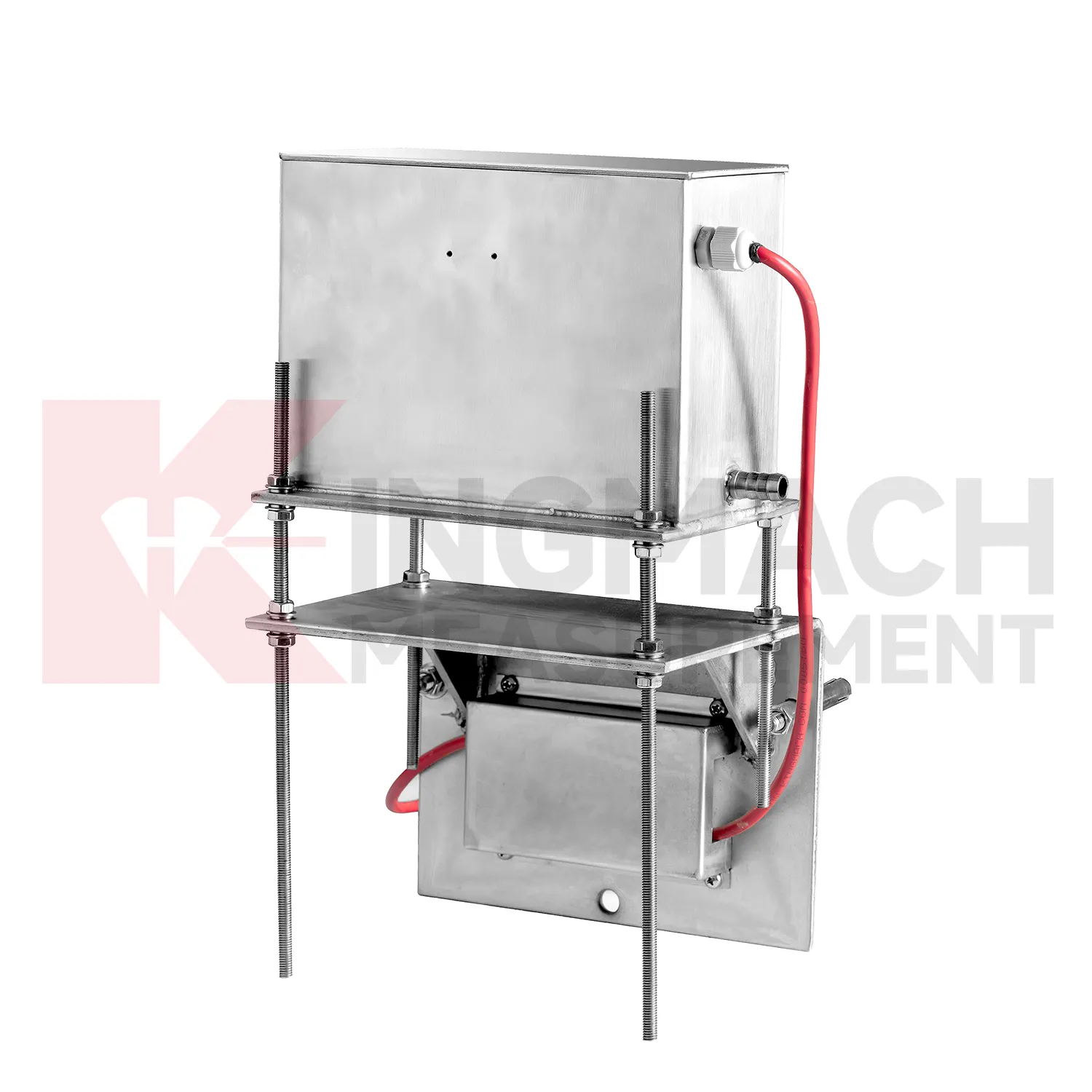
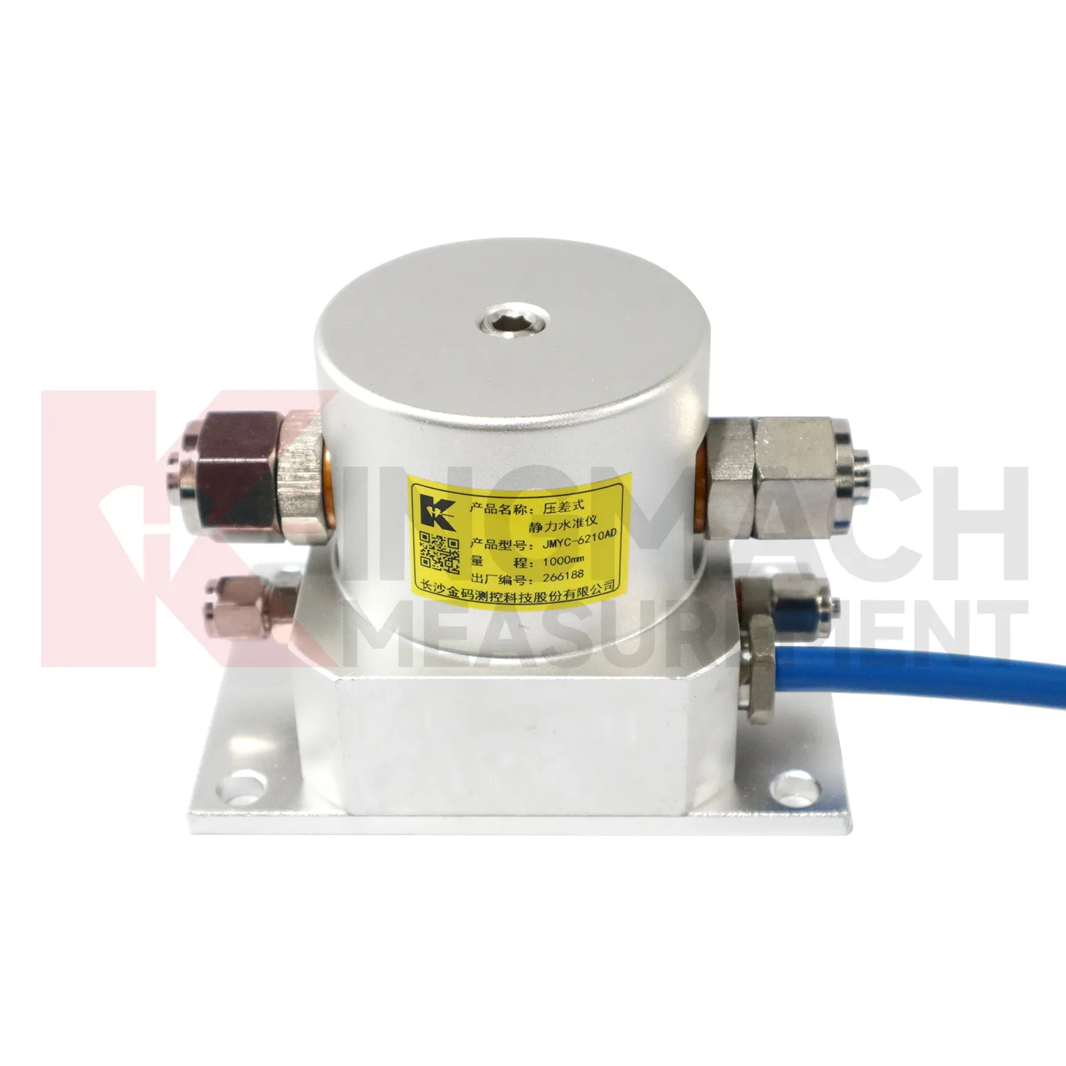
Kingmach Magnetic Ring Settlement Water Level Gauge also cover the JMQJ-62XXADT micro range hydrostatic level sensor, a compact instrument for small vertical deformation where fine reading stability matters more than large travel. The product page lists 50 mm and 100 mm ranges, 0.01 mm resolution, 0.5%FS accuracy, RS485 digital signal, DC 9V to 24V power, power consumption below 0.4W, IP68 protection, about 4.5 kg weight, temperature drift of plus or minus 0.001 mm per degree Celsius, and annual stability of plus or minus 0.1%FS. Typical sites include tunnels, subgrades, dams, bridges, slopes, and building foundations. Because the measuring span is small, installation quality has a strong effect on the usefulness of the readings. The installer should keep the mounting surface firm, shield the cable gland from standing water, protect the pipe connection, and label each sensor before cabinet wiring. Acceptance should include zero confirmation, response comparison between nearby locations, enclosure inspection, and a saved baseline table. For wet galleries, buried sections, or tunnel invert areas, the IP68 enclosure and low power demand help the instrument remain practical when access is limited. This model fits monitoring programs where gradual millimeter-scale movement must be recorded through long wet or buried service conditions.
Application of Magnetic Ring Settlement Water Level Gauge
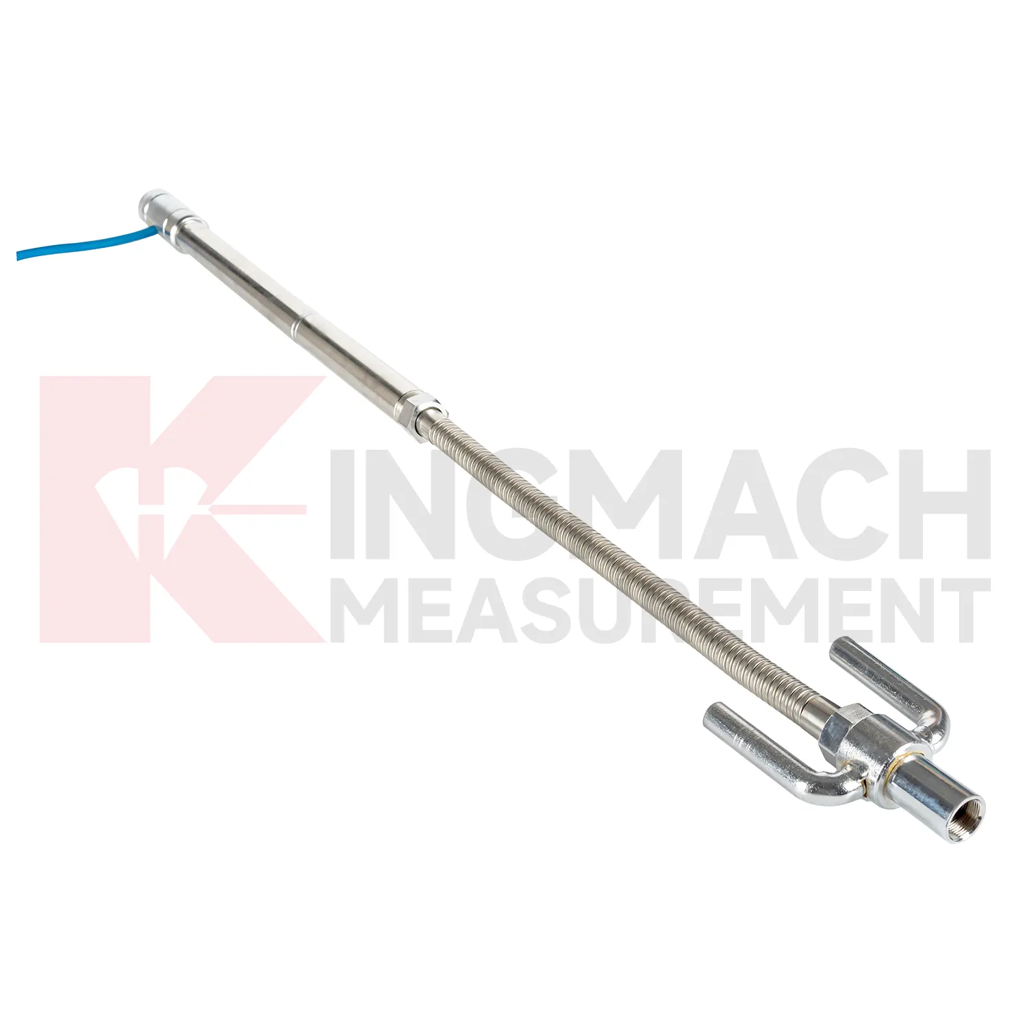
Pile foundations, dykes, and embankments use Magnetic Ring Settlement Water Level Gauge to verify vertical response during loading, filling, or long-term service. Kingmach JMDL-47XXAT is described for pile foundation settlement, dyke compression deformation, embankment heave, roadbed settlement, and base uplift in deep foundation pits. Its assembly includes a settlement plate, electrical displacement sensor, measuring rod with metal flexible conduit, anchor head, extension rod, and bottom anchor head. Published range options are 100 mm, 200 mm, 300 mm, and 400 mm, with gauge lengths from 760 mm to 2210 mm. Because the sensor is embedded, the installation record is almost as important as the reading itself. Crews should document depth, plate position, rod connection, cable exit, protection method, and nearby fill material before the location is covered. During loading, the curve can be checked against fill height, pile test stage, water condition, and surface survey marks. The side-exit cable arrangement helps reduce interference during pavement compaction, which is useful when monitoring must continue as construction equipment passes over the area.
The future of Magnetic Ring Settlement Water Level Gauge
The future of Magnetic Ring Settlement Water Level Gauge will include cleaner digital handover records. Settlement monitoring often lasts longer than the construction team stays on site, so owners need more than a table of values. A useful handover file should include model, serial number, range, reference point, tube route, ring depth, baseline, installation photo, cable tag, borehole number, and first stable reading. Kingmach products such as JMDL-47XXAT and JMCJ-1003/1005 especially benefit from this because embedded rods, magnetic rings, anchors, and borehole readings may be hard to inspect later. When that information is stored with the curve, maintenance teams can understand why a point was installed and how its settlement should be interpreted years later. Future records should make the instrument history as visible as the measurement itself, so old readings can still be trusted after staff changes, repairs, and new construction stages.
Care & Maintenance of Magnetic Ring Settlement Water Level Gauge
Hydrostatic Magnetic Ring Settlement Water Level Gauge need regular checks of the liquid path. For systems using JMDL-62XXADT, JMQJ-62XXADT, or JMYC-62XXAD, inspect water pipes, connectors, sensor elevation, reference point, cabinet wiring, and tube protection. Kinks, leakage, air pockets, freezing risk, or construction damage can change the apparent settlement curve. Check whether readings change after pipe work, cabinet maintenance, or nearby excavation. For outdoor systems, protect tubes from vehicle traffic, sharp edges, workers, and animal damage. When a reading shifts suddenly, confirm the reference sensor and water path before treating the value as structural movement. Hydrostatic systems can be very useful, but they depend on a clean, continuous, well-documented connection between points. The record should include who inspected the point, what changed on site, and whether nearby instruments showed the same trend, so the maintenance team can separate sensor trouble from real settlement. The record should include who inspected the point, what changed on site, and whether nearby instruments showed the same trend, so the maintenance team can separate sensor trouble from real settlement.
Kingmach Magnetic Ring Settlement Water Level Gauge
In underground works, Magnetic Ring Settlement Water Level Gauge help separate vertical movement from the noise of excavation, support installation, groundwater, and nearby traffic. Tunnel bottom uplift, subway station settlement, foundation pit base heave, and adjacent ground movement can all affect construction safety. Kingmach JMDL-47XXAT is described for tunnel bottom uplift and base uplift in deep foundation pits, while hydrostatic products can compare several elevations across a station or tunnel section. The monitoring plan should define which reading triggers inspection, who receives the alert, and what nearby data should be checked. Settlement should be reviewed with displacement, support force, water level, tilt, and visual inspection. That wider view keeps a single curve from being overread or ignored. For critical infrastructure, the settlement point should be part of a wider review with displacement, tilt, strain, load, rainfall, and groundwater information. For critical infrastructure, the settlement point should be part of a wider review with displacement, tilt, strain, load, rainfall, and groundwater information.
FAQ
Q: What does JMDL-47XXAT measure?
A: It measures in-situ subgrade settlement, embankment heave, foundation pit base uplift, tunnel bottom uplift, dyke compression, and pile foundation settlement.
Q: What ranges are listed for JMDL-47XXAT?
A: The listed ranges are 100 mm, 200 mm, 300 mm, and 400 mm, with 0.01 mm resolution on the 100 and 200 mm models and 0.1 mm on larger models.
Q: How is the gauge installed?
A: It uses a settlement plate, electrical displacement sensor, measuring rod, metal flexible conduit, anchor head, extension rod, and bottom anchor head.
Q: Can traffic operation continue during monitoring?
A: The side-exit cable routing is designed to avoid interference with pavement compaction and can support monitoring during traffic operation when installed correctly.
Q: What should be recorded during installation?
A: Record plate position, anchor depth, extension length, cable route, baseline, model, range, and construction stage.
Reviews
Robert Taylor
The weir flow meter is well-built and delivers accurate measurements. Great value for water management applications.
Andrew Lee
The visualization software is intuitive and powerful. It helps us analyze monitoring data efficiently.
Latest Inquiries
To protect the privacy of our buyers, only public service email domains like Gmail, Yahoo, and MSN will be displayed. Additionally, only a limited portion of the inquiry content will be shown.
Charlotte***@gmail.comUnited Arab Emirates
Hi, we require instrumentation cables suitable for harsh environments. Could you advise on specifica...
Emma***@gmail.comCanada
Dear Sir/Madam, we are interested in displacement transducers and settlement sensors for a geotechni...
Related product categories
- Micro Range Hydrostatic Level Sensor
- Single-point Settlement Meter
- Optical Deflection Monitor
- Inclinometer-based Hydrostatic Leveling System
- Settlement Monitoring Rod
- Hydrostatic Leveling System
- Photoelectric Deflectometer
- gnss settlement sensors
- settlement sensor
- settlement sensors
- rod settlement gauge
- settlement gauge